Lonely Planet Nepal The Kathmandu Valley

Images of Kathmandu


Banepa
Lonely Planet Trekking and Climbing in Nepal Kathmandu Valley Map


Town of Banepa

Banepa

Banepa is a town some 26km to the east of Kathmandu

Banepa is a major economic centre as the Arniko Rajmarg
highway connecting Nepal and China ( Tibet ) 
passes through the town.


Drying Corn at Banepa

Drying Corn

at

Temple

in

Banepa


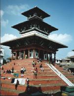
Chandeshwari Temple at Banepa

Chandeshwari Temple at Banepa


Main Street in Banepa

Main Street in Banepa


The outskirts of Kathmandu

The outskirts of Kathmandu


Kathmandu Gallery Photo Gallery

<< Back :: Nepal Photo Albums

Nepal Climbs & Treks : Nepal Peaks : Nepal Landscapes


Site Index : Worldwide Mountaineering : Adventure Travel

fb icon google+ icon  Linkedin icon  twitter


Nepal Books & Maps:-


Lonely Planet Nepal Rough Guide Nepal Lonely Planet - Kathmandu MapKathmandu Valley Map Trekking and Climbing in Nepal Lonely Planet - Trekking in NepalThe Trekking Peaks of Nepal Trekking in Nepal

Nepal Mountaineering Guide Trekking in the Everest Region Everest: A Trekkers Guide Trekking in the Annapurna RegionTrekking in the Everest RegionTrekking in the Annapurna RegionTrekking in the Annapurna RegionTrekking in Nepal - D'Abbundo

Footprint Nepal Nepal Handbook by Kerry MoranThe Kathmandu Valley Kathmandu Bikes and Hikes Annapurna: First Conquest of an 8000m Peak Tilman: The 7 Mountain Travel BooksKangchenjunga Trekkers Guide


Google Analytics


Google Analytics

extremetracking
 eXTReMe Tracker


extremetracking
Sitelock caingram.com
SiteLock
Sitelock
Sitelock caingram.info
SiteLock
Sitelock